- Thumbnail
- Resource ID
- 83ff1e5f-9d22-11e9-8d7d-000d3ab6a624
- Title
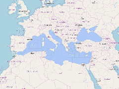
- GSAS - Mediterranean Fishing Zones
- Date
- July 2, 2019, 6:38 p.m., Publication
- Abstract
- http://www.gfcmonline.org/maps/gsas/
- Edition
- --
- Owner
- gridanode
- Point of Contact
- devrsgis@gmail.com
- Purpose
- --
- Maintenance Frequency
- None
- Type
- not filled
- Restrictions
- None
- None
- License
- None
- Language
- eng
- Temporal Extent
- Start
- --
- End
- --
- Supplemental Information
- No information provided
- Data Quality
- --
- Extent
-
- long min: -5.5999999046
- long max: 41.7795280000
- lat min: 30.2662219992
- lat max: 47.2895559991
- Spatial Reference System Identifier
- EPSG:900913
- Keywords
- no keywords
- Category
- None